While russian 🇷🇺 army is making progress south of Pokrovsk city in the Donbass region, ukrainian defenders continue to improve their fortifications.
Here is an overview, with maps and images of how Pokrovsk is turning into a stronghold.
When russian forces broke through ukrainian defenses in Avdiivka from october 23 to february 24, Ukraine began diging new defensive lines.
Line 0 was the most important and the most solid one, unfortunately, the part that was still resisting (Toretsk-Marinka) fell.
Lines 0.5, 1 and 2 weren’t finished. What i call 0.5 is a few trenches that resisted well before the Ocheretyne breakthrough.
Line 1 held a month and line 2 was lost without a fight in july and august 2024.
The current frontline is between lines 3 and 4, both holding.
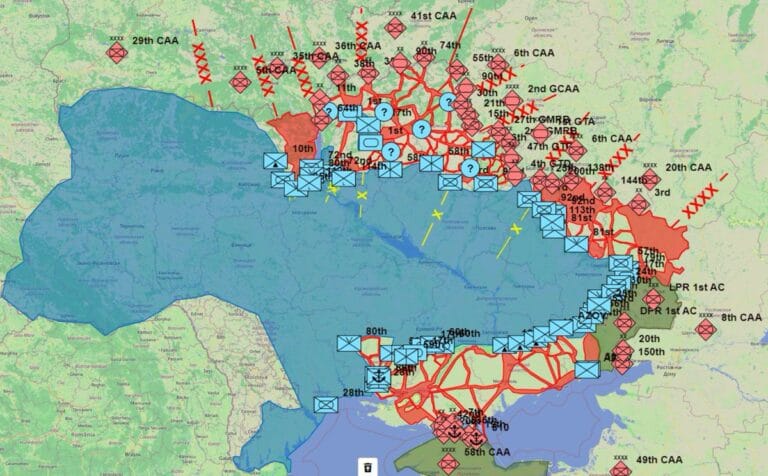
Here is a simplified view of those lines.
Now, the only possibility is to dig new lines north and west of Pokrovsk.
Here is the same map with the main axis of attack of russian forces during 2024.
We can see they followed the Avdiivka-Pokrovsk railway in a first time and then the Krasnohorivka-Pokrovsk railway south of the city.
On this map, you can see the main towns of eastern Ukraine. Pokrovsk is the last big city in south-Donetsk and south-eastern front.
The city is still a main road hub for the Donetsk region, 4 roads are still entering it, with one at 2km from the current frontline.
On this other map, we can see I added the fortifications, you can see their is an effort to reinforce Dnipro approch west of the city, with two main lines facing russian current progress.
New lines are also under construction north of Pokrovsk.
What next ?
I believe russian forces will try to take Udachne while securing their southern flanks, before making progress to isolate Pokrovsk from the west.
Then, they will try to enter the city from the south and the east after destroying ukrainian defenses there.
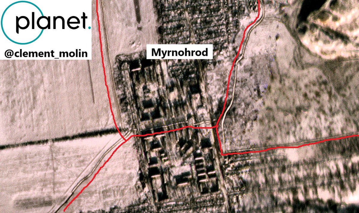
East of the city, the third line is still holding, despite recent assaults. There are some trenches all the way to Myrnohrod.
Worth knowing Hrodivka, Novohrodivka and Selydove allow russian forces to mass soldiers and armour, while Pokrovsk and Myrnohrod have the same role for Ukraine.
Inside Pokrovsk and Myrnohrod, numerous roads are being blocked by dragon teeths and obstacles to avoid mechanized assaults into the cities.
Trees have also been cut down to stop assaults into the city.
Here is a view of Myrnohrod ditches, with one of them passing through the city center.
You can also see on the right scares of recent bombings.
Here is the town of Shevchenko, where you can see a lot of bombings, the paths used by russian and ukrainian armour and a ditch west of this town.
Here are other images of Russia bombing ukrainian positions in forest strips south of Pokrovsk.
Those are @ Planet images, you can’t use them.
North of Pokrovsk, many new lines are under construction.
Here are 4 Sentinel-2 images showing ditches and trenches north of the city. This is open access data.
In red are the most recent trench modifications. Most of them are north of Pokrovsk where the main effort is currently ongoing.
The direction of Pokrovsk is the one where the fighting has been the most violent for a year, it is the one where there are the most men and resources engaged and the one where Russia is advancing the most.
It is therefore the one that has the most resources to dig defenses.
Currently, two logics are at work: preparing the city’s defenses to the west, north and east (this is no longer possible in the south with the proximity of the battlefield) and preparing for after Pokrovsk, lines of defense in other directions: Pavlohrad, Dobropilla and Kostiantynivka.
Once again, the Russian army is sneaking into the least defended places, there is clearly a lack of a line south of Udachne, to protect the west of Pokrovsk…
Thank you for reading, don’t forget to follow my other account @atummundi.
Next, we will talk about other fortification effort across Ukraine, in french.
Clément Molin


